ARMENTROUT SURVEYING & MAPPING
Professional Land Surveyor in VA & NC
To better serve our clients we accept MasterCard, Visa, Discover, PayPal & Bank Debit Cards

I'm a professional land surveyor in the states of North Carolina & Virginia.
A member of the NCSS (North Carolina Society of Surveyors) & the VAS (Virginia Association of Surveyors). I've also been a member of the NFIB (National Federation of Independent Business) for nearly 25 years.
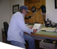
I started Armentrout Surveying & Mapping in May of 1994 with a goal to help "piece the world together one parcel or tract at a time". I've created this site to help the general public understand what goes on in the background for preparing to do a survey of their property & try to show how those boundary problems are resolved. I've also added some links to sites that are very useful to a surveyor or anyone interested in learning more about the profession of surveying.
~~~As a child I wondered, "How'd they do that?"~~~
Years ago, I watched surveyors work on the beginning of laying out Interstate 81 behind our house, (I was probably around 13 yrs. old) in doing so, I became curious about "how do these people know which way to take the road and how far to dig down to make this road work"? It really amazed me to watch the surveyors work, driving stakes into the ground then later dozers & graders came to build the road "all this from the stakes the surveyors drove into the ground."! From that time in my life, I've always been fascinated about the surveyors job. How do they go about doing this type of work and what kind of schooling do they need to do it? Not knowing that a "seed" was planted that eventually lead me to want to become one of those surveyors.
Many years passed after my experiences with the surveyors. I found that taking drafting in high school might enlighten me as to some of what went on in the laying out of the interstate. About 2 years after graduating from high school, a position was available in a local surveying company, where I learned to do drafting for survey maps. I became very curious again about "how do these people find these things out in the woods, like stones, trees, iron pipes and the like"? Then I wanted to go out on the survey crew so I could experience these things, kind of like a detective. You're searching for peoples corners like a detective searches for facts and clues in a crime.
To a surveyor, it is a feeling of great accomplishment when you find that old "lost" corner that had been forgotten by almost everyone. Not to mention, to finally create the final product, the survey plat. This is one of the most important documents (in my opinion) a person will ever have.
If you have any questions, please fell free to email me or call us. Our friendly & experienced staff will be glad to help you.


Member of NCSS Member of VAS
With over 90 years of combined experience, knowledge & understanding of the different facets of the surveying profession, my company utilizes today's technology to accommodate your surveying needs......whether it's a small lot, large timber boundary or commercial development or a boundary dispute.......no job is too small.
Land Surveying or related seminars completed by G.B. Armentrout, PLS.

Greg Armentrout, PLS. **
Professional Land Surveyor
10/1995 * Land Surveying Boundary Law
11/1996 * Preparation for Boundary Litigation by the Land Surveyor
09/1997 * GPS Seminar
09/1997 * GIS Seminar
10/1998 * Evidence & Procedures in Boundary Retracement
11/1998 * N.C. Case Law of Boundaries & Surveying
12/1999 * Construction Surveying Proposing & Contracting
02/2000 * Written & Implied Easements
03/2000 * Boundary Retracement
01/2001 * GIS & GPS & their Impact on Boundary Law
01/2001 * Virginia Boundary Law & Landowner Disputes
05/2002 * George Washington – Colonial Surveyor
12/2002 * GPS & the Land Surveyor
12/2003 * Subdivision Design for Land Surveyors
09/2005 * GPS for 3rd Order Surveyors
12/2005 * Acreage Boundary Surveys
11/2006 * Boundary Retracement
11/2008 * Business Practices for the 21st Century
11/2009 * N.C. (CFS) Certified Floodplain Surveyor
10/2011 * Boundary Retracement & Legal Aspects
11/2011 * Pipeline Emergency Response & Damage Prevention Training
12/2011 * Litigating a Survey Dispute/Mock Trial
07/2012 * Best Practices in GPS Surveying
10/2012 * Floodplain Elev. Certificates & Floodplain Issues
10/2012 * Seven Deadly Sins of Surveying
12/2012 * N.C. Standards of Professional Conduct for Land Surveyors
11/2013 * ALTA Standards & Ethics in Surveying
12/2013 * Documentation: Self Defense for Professionals
12/2013 * Disputes Between Adjoining Landowners
12/2013 * Water Rights
12/2013 * Legal Descriptions
12/2013 * Rights & Responsibilities in the Lands of Others:
The Effect of Easements on Surveyors
04/2014 * Floodplains & FEMA/NFIP
11/2014 * Damage Prevention & Online Ticket Training – VA811
11/2014 * Modernization of the National Spatial Reference System
11/2015 * Aerial Imagery, Flood vents, Railroad Safety & Tech. of Surveying
12/2015 * Evidence, Exhibits & Testimony
06/2016 * Floodplains FEMA/NFIP
12/2017 * Seized Lands: Eminent Domain
12/2017 * Adverse Possession & Prescriptive Easements
12/30/19 * Utilities Public and Otherwise
12/30/19 * Floods Happen: Where and Why
12/30/19 * Ethical Practice in Engineering and Land Surveying
12/30/19 * Boundaries and Monuments
12/30/19 * 3D Scanning Surveys
08/2021 * Boundary Disputes between States
08/2021 * Boundary Law – Colonial States
08/2021 * Monumentation & Water Law


